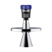


SLDL53-70 Series
SLDL53-70 Series Laserscan Fully Automatic 3D Laser Stockpile Scanner (Ceiling-Mounted)

- Product Introduction
Solidat Applied Technologies Ltd. is one of the leading manufacturers and suppliers of sldl53-70 series in China, also supports customized service. Please feel free to buy high quality products in stock here and get quotation from our factory. Good service and reasonable price are available.
SLDL53-70 Series
Laserscan Fully Automatic 3D Laser Stockpile Scanner (Ceiling-Mounted)
Ceiling-mounted inverted installation above the bulk material in an enclosed stockyard
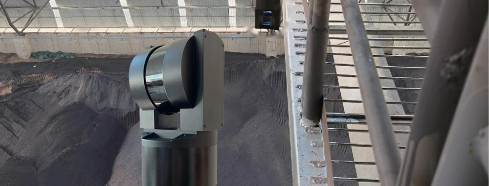
SLDL53-70 Laserscan mounted upside-down on the shed roof, scanning the stockpile below
Operational Principle
The SLDL53-70 Laserscan is an integrated, fully automatic high-speed three-dimensional laser scanner designed for fast, accurate volume and inventory measurement of irregular bulk-material piles in coal sheds, mines, power plants, steel mills, grain/bran warehouses and material yards. Mounted upside-down on the shed roof, it performs contactless high-density data acquisition over the whole material surface. The control software merges the scan data, applies digital surface fitting to build the digital terrain model (DTM), and calculates pile volume by volume integration; multiplying the volume by the material bulk density gives the stored mass. The complete workflow - scanning, 3D modeling, volume calculation and report generation - runs automatically without manual intervention.
Features & Benefits
- High-frequency, high-precision scanning sensor: up to 20,000 points/second; full 360° horizontal and 300° vertical field of view.
- Remote control via data cable (RS232 / Ethernet): real-time 3D graphics of the shed interior.
- One complete scan of the stockyard takes only 2–5 minutes; one-click operation, no on-site operator required.
- Automatic generation of stockpile inventory reports in user-defined formats.
- Measuring range up to 500 m (minimum 2 m); point error < 20 mm; scan resolution 1 mm; horizontal angular accuracy 2 arcsec; volume error < 0.5 %.
- Single-unit or multi-unit ceiling installation; multiple scanners networked over LAN / Wi-Fi with scheduled automatic scanning.
- 905 nm Class 1 eye-safe laser with strong dust-penetration capability; reliable in dusty shed environments.
- IP67 housing with self-heating for −40 °C operation; compact 145×145×325 mm, only 4.5 kg.
- Automatic noise reduction and filtering; roof and wall noise points removed automatically.
- Optional upgrade to a GNSS/GPS outdoor version for large-range open-air stockyard scanning.
3D Modeling & Volume Calculation Software
Real-time 3D surface imaging, DTM modeling, volume/mass calculation and multi-shed inventory reports. Networked scanners are scheduled automatically, and the control centre merges their data into a single 3D yard view.
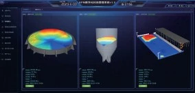
Control software: round silo, bin and long stockpile modelled in one dashboard

2D contour / volume heat map of a scanned stockpile
Product Overview
The scanner uses an industry-grade high-frequency, high-precision sensor for full-view 360° horizontal scanning at 20,000 points/second, with horizontal angular accuracy up to 2 arcsec, range up to 500 m and point error below 20 mm. The complete instrument with pan-tilt weighs only 4.5 kg and one scan pass takes 2–5 minutes. Designed for inverted suspension on the shed roof, it is remotely controlled via computer software over a data cable, delivering full-field pile-surface 3D coordinates with one click. Single- or multi-scanner ceiling installations are supported; networked scanners are scheduled automatically, and the control center merges the data, builds the DTM, calculates volume by integration and renders the 3D yard view.

3D point-cloud model of a long stockpile built from SLDL53-70 scan data
Technical Parameters
Scanning Parameters
| Horizontal scan range | 0–360° |
| Vertical scan range | 0–300° |
| Scan resolution | 1 mm |
| Point error | < 20 mm |
| Vertical angular accuracy | 0.09° |
| Horizontal angular accuracy | 2 arcsec (0.0005°) |
| Point acquisition rate | 20,000 points/second |
| Scan cycle | 2–5 minutes per pass |
Range & Accuracy
| Volume error | < 0.5 % |
| Minimum range (non-cooperative target) | 2 m |
| Maximum range (non-cooperative target) | 500 m |
Laser
| Laser wavelength | 905 nm |
| Laser class | Class 1 eye-safe laser |
Data & Communication
| Data format | TXT, ASC |
| Communication interface | RS232 / Ethernet (LAN / Wi-Fi networking) |
Physical
| Weight (with pan-tilt) | 4.5 kg |
| Dimensions | 145×145×325 mm |
| Protection rating | IP67 |
| Working temperature | −40 °C to +60 °C (self-heating included) |
| Storage temperature | −40 °C to +80 °C |
| Power supply | 12 / 24 V DC |
Applications
- Pile volume calculation and variation analysis in power plants
- Digital stockyard and 3D modeling of enclosed material sheds
- 3D building scanning and earthwork measurement
- Volume / capacity calibration of storage tanks and silos

Pile volume calculation and variation analysis in power plants

Digital stockyard and 3D modeling of enclosed material sheds

3D building scanning and earthwork measurement

Facade scan heat map produced by 3D laser scanning

Volume / capacity calibration of storage tanks and silos
Typical industries: coal-fired power plants, steel mills, coal mines, cement plants, grain and bran warehouses, ports and bulk-material terminals. An outdoor GNSS/GPS version is available for open-air stockyards and large-range stockpile scanning.
Hot Tags: sldl53-70 series, China sldl53-70 series manufacturers, suppliers, factory, 3D radar, 80 GHz Radar Level Transmitter, guided wave radar interface level transmitter, radar level gauge working principle, Radar Level Gauges, Radar Level Meter